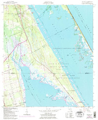
1949 Map of Oak Hill
USGS Topo · Published 1997About this map
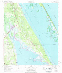
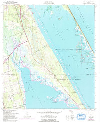
Large Spanish Land Grants define the geography of the Florida coastline here, including the John Mc Intosh Grant and Gomez Grant, which stretch across the mainland between the Florida East Coast railroad and the brackish waters of the Indian River. The settlement of Oak Hill serves as a local hub near the Turnbull Creek headwaters, while further south, the community of Shiloh sits at the border of Volusia and Brevard counties. This coastal landscape is dominated by the complex waterways of Mosquito Lagoon, where features like Glory Hole and Hole in the Wall indicate the intricate tidal channels once used for navigation and fishing. The transition from early settlement to federal preservation is evident in the designation of the Canaveral National Seashore and the John F Kennedy Space Center (NASA), which encompass much of Merritt Island.
Find a feature on this map
52 named features on this map. Tap any name to fly to it.
Don’t see what you’re looking for? This feature index may not catch every label — zoom into the map to look around manually.
Map Details
Editions of this 1949 Oak Hill Map
7 editions found
Other maps of this area

1949 · Oak Hill
USGS Topo · 1:24,000

1949 · Pardon Island
USGS Topo · 1:24,000

1949 · Wilson
USGS Topo · 1:24,000

1949 · Mims
USGS Topo · 1:24,000

1950 · Maytown
USGS Topo · 1:24,000

1950 · Ariel
USGS Topo · 1:24,000

1950 · Edgewater
USGS Topo · 1:24,000

1950 · Aurantia
USGS Topo · 1:24,000

1952 · Mims
USGS Topo · 1:24,000

1952 · Wilson
USGS Topo · 1:24,000