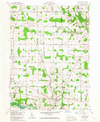
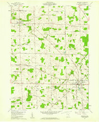
1960 Map of Olivesburg
USGS Topo · Published 1967About this map
The agrarian landscape where Richland, Ashland, and Huron Counties meet is defined by the rigid grid of the Connecticut Western Reserve Base Line Road and the Base Line Road. This 1960 field survey reveals a settled countryside of family-named thoroughfares like Clayberg Road and Lattimer Road, centered on small rural hubs. Adario stands at a central crossroads, while further south, the village of Olivesburg sits near the winding waters of the Whetstone Creek.
Find a feature on this map
43 named features on this map. Tap any name to fly to it.
Don’t see what you’re looking for? This feature index may not catch every label — zoom into the map to look around manually.
Map Details
Editions of this 1960 Olivesburg Map
4 editions found
Other maps of this area

1908 · Ashland
USGS Topo · 1:62,500

1908 · New London
USGS Topo · 1:62,500

1915 · Norwalk
USGS Topo · 1:62,500

1915 · Crestline
USGS Topo · 1:62,500

1943 · Crestline
USGS Topo · 1:62,500

1944 · Norwalk
USGS Topo · 1:62,500

1950 · Marion
USGS Topo · 1:250,000

1956 · Toledo
USGS Topo · 1:250,000

1960 · New London
USGS Topo · 1:24,000
1960 · Greenwich
USGS Topo · 1:24,000
Featured Places
- Savannah, OH
- Clear Creek Township, OH
- Butler Township, OH
- Blooming Grove Township, OH
- Ruggles Township, OH