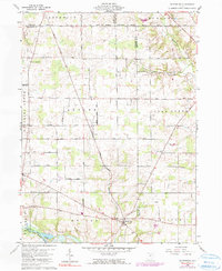
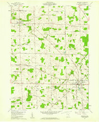
1960 Map of Olivesburg
USGS Topo · Published 1990About this map
The boundary between the Congress Lands and the old Connecticut Western Reserve Base Line Road bisects this landscape, marking a significant historical shift in Ohio's early land surveying and settlement patterns. The small community of Adario sits central to the quadrangle, surrounded by a network of family-named roads like Strimple Road and Ninevah Road that trace the rural development of Richland and Ashland counties. To the south, the waters of the Black Fork Mohican River feed into Charles Mill Lake, while the north is drained by the headwaters of the Vermilion River. Genealogists will find notable local landmarks such as Amiah Sch, Clear Creek Ch, and the Blooming Grove Cem, which serve as anchors for the scattered agricultural settlements of Shenandoah and Olivesburg.
Find a feature on this map
41 named features on this map. Tap any name to fly to it.
Don’t see what you’re looking for? This feature index may not catch every label — zoom into the map to look around manually.
Map Details
Editions of this 1960 Olivesburg Map
4 editions found
Other maps of this area

1908 · Ashland
USGS Topo · 1:62,500

1908 · New London
USGS Topo · 1:62,500

1915 · Norwalk
USGS Topo · 1:62,500

1915 · Crestline
USGS Topo · 1:62,500

1943 · Crestline
USGS Topo · 1:62,500

1944 · Norwalk
USGS Topo · 1:62,500

1950 · Marion
USGS Topo · 1:250,000

1956 · Toledo
USGS Topo · 1:250,000

1960 · New London
USGS Topo · 1:24,000
1960 · Greenwich
USGS Topo · 1:24,000
Featured Places
- Savannah, OH
- Clear Creek Township, OH
- Butler Township, OH
- Blooming Grove Township, OH
- Ruggles Township, OH