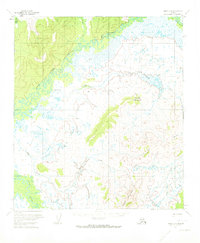
1954 Map of Ophir D-1
USGS Topo · Published 1973About this map
The Innoko River and its meandering tributaries dominate this interior Alaskan landscape, recorded during the mid-1950s. The terrain is characterized by broad, low-lying wetlands and complex drainage systems, where the West Fork Innoko River meets the main channel. Dominant heights such as Lone Jim Mountain and Hunch Mountain provide the primary landmarks in an area otherwise defined by seasonal watercourses like Fourmile Creek and Slane Creek.
Find a feature on this map
10 named features on this map. Tap any name to fly to it.
Don’t see what you’re looking for? This feature index may not catch every label — zoom into the map to look around manually.
Map Details
Editions of this 1954 Ophir D-1 Map
2 editions found
Other maps of this area

1945 · Nulato
USGS Topo · 1:250,000

1950 · Medfra
USGS Topo · 1:250,000

1951 · Ophir
USGS Topo · 1:250,000

1951 · Nulato
USGS Topo · 1:250,000

1951 · Ruby
USGS Topo · 1:250,000

1952 · Nulato A-2
USGS Topo · 1:63,360

1952 · Ruby A-6
USGS Topo · 1:63,360
1952 · Nulato A-1
USGS Topo · 1:63,360

1952 · Nulato
USGS Topo · 1:250,000

1952 · Ruby
USGS Topo · 1:250,000