
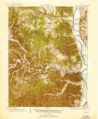
1915 Map of Otway
USGS Topo · Published 1958About this map
The Scioto River valley serves as a primary corridor for early 20th-century transportation and settlement on this sheet, which captures a landscape defined by deep ridges and an extensive network of country schools. Major rail lines including the Norfolk and Western RR and the Scioto Valley and New England RR follow the winding paths of Brush Creek and its tributaries, connecting timber and farming communities like Otway, McDermott, and Rarden.
Find a feature on this map
102 named features on this map. Tap any name to fly to it.
Don’t see what you’re looking for? This feature index may not catch every label — zoom into the map to look around manually.
Map Details
Editions of this 1915 Otway Map
2 editions found
Other maps of this area

1906 · Waverly
USGS Topo · 1:62,500

1908 · Waverly
USGS Topo · 1:62,500

1911 · Sciotoville
USGS Topo · 1:62,500

1913 · Sciotoville
USGS Topo · 1:62,500

1915 · Bainbridge
USGS Topo · 1:48,000

1915 · Garrison
USGS Topo · 1:62,500

1915 · Piketon
USGS Topo · 1:62,500

1916 · Peebles
USGS Topo · 1:62,500

1917 · Bainbridge
USGS Topo · 1:62,500

1917 · Piketon
USGS Topo · 1:62,500