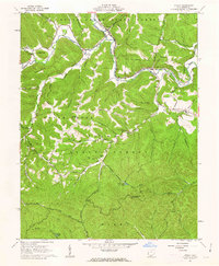
1961 Map of Otway
USGS Topo · Published 1962About this map
The Norfolk and Western railway corridor dictates the settlement pattern of this early 1960s landscape, winding through the valley of Brush Creek. Small communities like Otway and Henley serve as focal points for the surrounding rural ridges, while industrial activity is noted by a Strip Mine and a Substation. The map reveals a dense network of family-named cemeteries such as Garvin Cem, Jewett Cem, and Parker Cem, providing essential details for genealogists.
Find a feature on this map
69 named features on this map. Tap any name to fly to it.
Don’t see what you’re looking for? This feature index may not catch every label — zoom into the map to look around manually.
Map Details
Editions of this 1961 Otway Map
3 editions found
Other maps of this area

1915 · Garrison
USGS Topo · 1:62,500

1915 · Otway
USGS Topo · 1:62,500

1916 · Peebles
USGS Topo · 1:62,500

1917 · Otway
USGS Topo · 1:62,500

1918 · Garrison
USGS Topo · 1:62,500

1918 · Peebles
USGS Topo · 1:62,500

1919 · Vanceburg
USGS Topo · 1:62,500

1949 · Pond Run
USGS Topo · 1:24,000

1949 · Vanceburg
USGS Topo · 1:62,500

1949 · Friendship
USGS Topo · 1:24,000