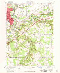
1960 Map of Painesville
USGS Topo · Published 1968About this map
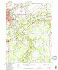
The Grand River carves a deep, winding path through Lake County, defining the geography of Painesville and the surrounding townships. During this mid-century period, the area exhibits a blend of established industrial infrastructure and growing suburban recreation. A dense network of railroads, including the NYC RR and the Baltimore and Ohio RR, converges on the city center, while sand and gravel operations like the Sand and Gravel Pits north of town suggest ongoing development.
Find a feature on this map
87 named features on this map. Tap any name to fly to it.
Don’t see what you’re looking for? This feature index may not catch every label — zoom into the map to look around manually.
Map Details
Editions of this 1960 Painesville Map
5 editions found
Other maps of this area

1904 · Chardon
USGS Topo · 1:62,500

1905 · Perry
USGS Topo · 1:62,500

1905 · Mentor
USGS Topo · 1:62,500

1906 · Chardon
USGS Topo · 1:62,500

1907 · Mentor
USGS Topo · 1:62,500

1950 · Cleveland
USGS Topo · 1:250,000

1953 · Chardon
USGS Topo · 1:24,000

1953 · Chesterland
USGS Topo · 1:24,000

1953 · Mentor
USGS Topo · 1:24,000

1956 · Cleveland
USGS Topo · 1:250,000