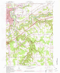
1960 Map of Painesville
USGS Topo · Published 1981About this map
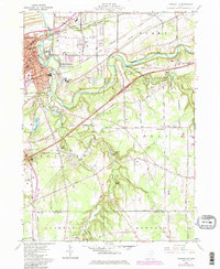
The Grand River carves a deep, winding path through Lake County, defining the landscape between the urban center of Painesville and the rural reaches of Leroy. During this mid-century period, the area maintains a dense rail infrastructure with the P C RR, Baltimore and Ohio RR, and Norfolk and Western RR all converging near the city. This transportation network supported local industry, evidenced by the Quarry and various Sand and Gravel Pits located along the river bluffs.
Find a feature on this map
85 named features on this map. Tap any name to fly to it.
Don’t see what you’re looking for? This feature index may not catch every label — zoom into the map to look around manually.
Map Details
Editions of this 1960 Painesville Map
5 editions found
Other maps of this area

1904 · Chardon
USGS Topo · 1:62,500

1905 · Perry
USGS Topo · 1:62,500

1905 · Mentor
USGS Topo · 1:62,500

1906 · Chardon
USGS Topo · 1:62,500

1907 · Mentor
USGS Topo · 1:62,500

1950 · Cleveland
USGS Topo · 1:250,000

1953 · Chardon
USGS Topo · 1:24,000

1953 · Chesterland
USGS Topo · 1:24,000

1953 · Mentor
USGS Topo · 1:24,000

1956 · Cleveland
USGS Topo · 1:250,000