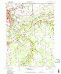
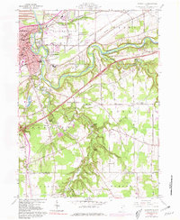
1960 Map of Painesville
USGS Topo · Published 1985About this map
The Grand River carves a deep, winding path through the heart of Lake County, defining the landscape between the urban center of Painesville and the rural reaches of Leroy and Concord. In the north, the industrial and transport identity of the era is evident through the convergence of Conrail and Norfolk and Western rail lines, alongside active Sand and Gravel Pits and a Quarry near the riverbanks. The transition from the dense street grids of the city to the woodland-dominated south is marked by numerous youth retreats and public lands, including Camp Klein, Mather Camp, and the burgeoning Big Creek State Park. Notable local landmarks such as Casement Airport and Harvey High Sch highlight the mid-century community infrastructure, while secluded features like Peace Hollow and Cascade Falls reveal the hidden topography along the tributaries of Paine Creek.
Find a feature on this map
78 named features on this map. Tap any name to fly to it.
Don’t see what you’re looking for? This feature index may not catch every label — zoom into the map to look around manually.
Map Details
Editions of this 1960 Painesville Map
5 editions found
Other maps of this area

1904 · Chardon
USGS Topo · 1:62,500

1905 · Perry
USGS Topo · 1:62,500

1905 · Mentor
USGS Topo · 1:62,500

1906 · Chardon
USGS Topo · 1:62,500

1907 · Mentor
USGS Topo · 1:62,500

1950 · Cleveland
USGS Topo · 1:250,000

1953 · Chardon
USGS Topo · 1:24,000

1953 · Chesterland
USGS Topo · 1:24,000

1953 · Mentor
USGS Topo · 1:24,000

1956 · Cleveland
USGS Topo · 1:250,000