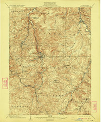
1904 Map of Patton
USGS Topo · Published 1922About this map
Patton sits at the heart of this early twentieth-century landscape, where the Pennsylvania RR and several industrial divisions carve through the Allegheny mountains. The settlement pattern follows the drainage of Chest Creek and Clearfield Creek, reflecting a region deeply tied to the extraction and transit of natural resources. Significant cultural and religious centers are scattered across the high ground, including St Bonifacius, St Lawrence, and St Augustine, serving the rural populations surrounding larger hubs like Hastings and Carrolltown. Industrial sites like Eckenrode Mill and Thomas Mills appear alongside specialized rail infrastructure such as Tunnel Siding and the Cresson and Irvona Branch. In the southeast, the topography becomes notably more dramatic as it approaches the Kittanning Gap and the headwaters of Burgoons Run, marking the transition into the Logan and Gallitzin regions.
Find a feature on this map
79 named features on this map. Tap any name to fly to it.
Don’t see what you’re looking for? This feature index may not catch every label — zoom into the map to look around manually.
Map Details
Editions of this 1904 Patton Map
5 editions found
Other maps of this area

1902 · Ebensburg
USGS Topo · 1:62,500

1902 · Patton
USGS Topo · 1:62,500

1902 · Barnesboro
USGS Topo · 1:62,500

1902 · Hollidaysburg
USGS Topo · 1:62,500

1903 · Curwensville
USGS Topo · 1:62,500

1903 · Hollidaysburg
USGS Topo · 1:62,500

1903 · Houtzdale
USGS Topo · 1:62,500

1904 · Barnesboro
USGS Topo · 1:62,500

1904 · Patton
USGS Topo · 1:62,500

1904 · Ebensburg
USGS Topo · 1:62,500