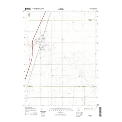
2015 Map of Paxton
USGS Topo · Published 2015About this map
Paxton serves as the primary hub of this East Central Illinois landscape, where a dense grid of streets like E Pells St and W Ottawa Rd gives way to expansive agricultural sections. The area is marked by a network of drainage and natural waterways, including the Big Four Ditch and the meandering Middle Fork Vermilion River in the southeast. Genealogists will find significant value in the distribution of rural burial sites, such as Trickle Grove Cem and Huffman Cem, which sit alongside the quiet Harwood Chapel. Small-scale aviation is represented by C D Maulding Airport and Hasselbring Airport, reflecting the region's reliance on local airstrips. The transition between Ford, Iroquois, and Champaign counties is clearly defined by the rectilinear road system, including Co Road 3500 N, illustrating the structured land division typical of the Illinois prairie.
Find a feature on this map
62 named features on this map. Tap any name to fly to it.
Don’t see what you’re looking for? This feature index may not catch every label — zoom into the map to look around manually.
Map Details
Editions of this 2015 Paxton Map
This is the sole edition of this map. No revisions or reprints were ever made.
Other maps of this area

1924 · Paxton
USGS Topo · 1:62,500

1927 · Paxton
USGS Topo · 1:62,500

1936 · Potomac
USGS Topo · 1:62,500

1939 · Cissna Park
USGS Topo · 1:62,500

1948 · Buckley
USGS Topo · 1:62,500

1949 · Cissna Park
USGS Topo · 1:62,500

1949 · Buckley
USGS Topo · 1:62,500

1949 · Paxton
USGS Topo · 1:62,500

1953 · Danville
USGS Topo · 1:250,000

1955 · Danville
USGS Topo · 1:250,000