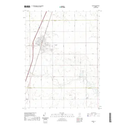
2021 Map of Paxton
USGS Topo · Published 2021About this map
Paxton serves as a prominent focal point in this East Central Illinois landscape, where the Ford County Courthouse stands at the center of a dense grid of streets including W Pine St and E Bogardus St. The geography transition south across the county line into Champaign County toward the settlement of Ludlow. This survey illustrates the intricate drainage patterns of the prairie, defined by the winding course of the Middle Fork Vermilion River and smaller waterways like Sugar Cr and Spring Cr. Local aviation is represented by the C D Maulding Airport east of the main town. For genealogists, the map is particularly useful for locating numerous burial sites scattered across the rural townships, including Glen Cem, Prospect Cem, Hall Cem, and the remote Harwood Chapel Cem near the southern map boundary.
Find a feature on this map
67 named features on this map. Tap any name to fly to it.
Don’t see what you’re looking for? This feature index may not catch every label — zoom into the map to look around manually.
Map Details
Editions of this 2021 Paxton Map
This is the sole edition of this map. No revisions or reprints were ever made.
Other maps of this area

1924 · Paxton
USGS Topo · 1:62,500

1927 · Paxton
USGS Topo · 1:62,500

1936 · Potomac
USGS Topo · 1:62,500

1939 · Cissna Park
USGS Topo · 1:62,500

1948 · Buckley
USGS Topo · 1:62,500

1949 · Cissna Park
USGS Topo · 1:62,500

1949 · Buckley
USGS Topo · 1:62,500

1949 · Paxton
USGS Topo · 1:62,500

1953 · Danville
USGS Topo · 1:250,000

1955 · Danville
USGS Topo · 1:250,000