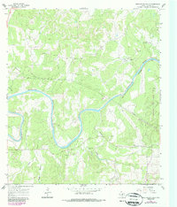
1967 Map of Pedernales Falls
USGS Topo · Published 1987About this map
The Pedernales River carves a deep path through this Hill Country landscape, defining the topography of Blanco County as it was documented in the late 1960s. This survey, later updated in the mid-1980s, highlights the emerging Pedernales Falls State Park and the network of private landholdings that shaped the area's rural character. Prominent family names are etched into the terrain at the Voyles Lazy V Ranch, Hill Ranch, and Baird Ranch, the latter of which features its own Airfield.
Find a feature on this map
19 named features on this map. Tap any name to fly to it.
Don’t see what you’re looking for? This feature index may not catch every label — zoom into the map to look around manually.
Map Details
Editions of this 1967 Pedernales Falls Map
4 editions found
Other maps of this area

1887 · Blanco
USGS Topo · 1:125,000

1894 · Blanco
USGS Topo · 1:125,000

1954 · Llano
USGS Topo · 1:250,000

1955 · Llano
USGS Topo · 1:250,000

1956 · Llano
USGS Topo · 1:250,000
1961 · Johnson City
USGS Topo · 1:24,000

1963 · Yeager Creek
USGS Topo · 1:24,000
1963 · Henly
USGS Topo · 1:24,000
1963 · Monument Hill
USGS Topo · 1:24,000
1967 · Round Mountain
USGS Topo · 1:24,000