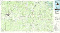
1985 Map of Pedernales River
USGS Topo · Published 1985About this map
The Pedernales River winds through the heart of the Texas Hill Country in this mid-1980s portrait of ranching heritage and growing parklands. At the center of the sheet lies the Lyndon B. Johnson National Historic Park, marking the presidential legacy near Stonewall and Johnson City. The map documents the established settlement patterns of the region, from the German-influenced hub of Fredericksburg in the west to the tranquil reaches of Luckenbach and Albert. Significant terrain features like Enchanted Rock State Park and Pedernales Falls State Park highlight the area's geological character, while the presence of the Southern Pacific Railroad indicates the enduring rail corridors. From the springs at Dripping Springs to the riverside community of Wimberley, the landscape is defined by its limestone peaks and the branching tributaries of the Blanco River and Onion Creek.
Find a feature on this map
103 named features on this map. Tap any name to fly to it.
Don’t see what you’re looking for? This feature index may not catch every label — zoom into the map to look around manually.
Map Details
Editions of this 1985 Pedernales River Map
2 editions found
Other maps of this area

1887 · Llano
USGS Topo · 1:125,000

1887 · Blanco
USGS Topo · 1:125,000

1887 · Mason
USGS Topo · 1:125,000

1887 · Burnet
USGS Topo · 1:125,000

1893 · Georgetown
USGS Topo · 1:125,000

1893 · Burnet
USGS Topo · 1:125,000

1894 · Mason
USGS Topo · 1:125,000

1894 · Fredericksburg
USGS Topo · 1:125,000

1894 · Kerrville
USGS Topo · 1:125,000

1894 · Blanco
USGS Topo · 1:125,000