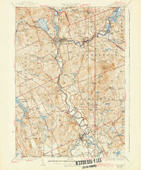
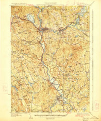
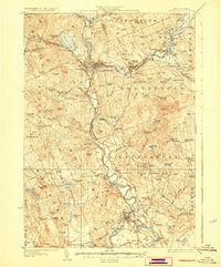
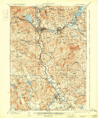
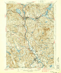
1927 Map of Penacook
USGS Topo · Published 1943About this map
Franklin Falls and the industrial activity of the Merrimack River corridor define this 1920s survey of Merrimack County. The landscape is dense with civic and educational history, featuring dozens of localized schoolhouses such as the Bashan School, Buckleboro School, and Dyers Crossing School. The Boston and Maine RR serves as the primary transport artery, connecting settlements like East Tilton, Gerrish, and Boscawen along the river's winding path.
Find a feature on this map
132 named features on this map. Tap any name to fly to it.
Don’t see what you’re looking for? This feature index may not catch every label — zoom into the map to look around manually.
Map Details
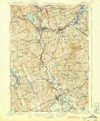
Editions of this 1927 Penacook Map
8 editions found

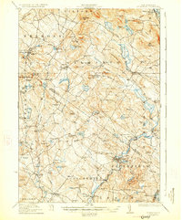
Other maps of this area

1909 · Winnepesaukee
USGS Topo · 1:62,500

1919 · Gilmanton
USGS Topo · 1:62,500

1921 · Suncook
USGS Topo · 1:62,500

1925 · Holderness
USGS Topo · 1:62,500

1926 · Hillsboro
USGS Topo · 1:62,500

1927 · Concord
USGS Topo · 1:62,500

1927 · Penacook
USGS Topo · 1:62,500
1927 · Gilmanton
USGS Topo · 1:62,500

1927 · Holderness
USGS Topo · 1:62,500

1927 · Cardigan
USGS Topo · 1:62,500