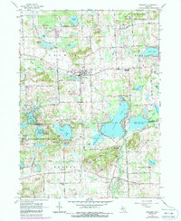
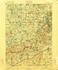
1965 Map of Pinckney
USGS Topo · Published 1988About this map
Glacial lakes and recreation areas dominate this landscape along the Livingston County and Washtenaw County border during the mid-1960s. The village of Pinckney serves as a central hub, connected by the Grand Trunk Western Railroad and anchored by local institutions like St Marys Church and Pinckney High School. To the west, the curiously named settlement of Hell sits near Hi-Land Lake, illustrating the region's transition from a rural agricultural economy to a premier destination for seasonal recreation.
Find a feature on this map
74 named features on this map. Tap any name to fly to it.
Don’t see what you’re looking for? This feature index may not catch every label — zoom into the map to look around manually.
Map Details
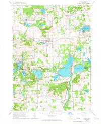
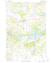
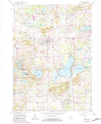
Editions of this 1965 Pinckney Map
4 editions found
Other maps of this area

1902 · Dexter
USGS Topo · 1:62,500

1904 · Ann Arbor
USGS Topo · 1:125,000

1906 · Dexter
USGS Topo · 1:62,500

1907 · Howell
USGS Topo · 1:62,500

1908 · Ann Arbor
USGS Topo · 1:125,000

1908 · Fowlerville
USGS Topo · 1:62,500

1909 · Howell
USGS Topo · 1:62,500
1910 · Fowlerville
USGS Topo · 1:62,500
1919 · Stockbridge
USGS Topo · 1:62,500
1922 · Stockbridge
USGS Topo · 1:62,500
Featured Places
- Hamburg Township, MI
- Putnam Township, MI
- Webster Township, MI
- Dexter Township, MI
- Pinckney, Putnam Township