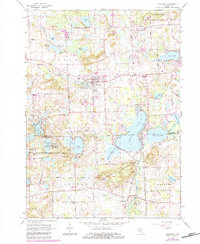
1965 Map of Pinckney
USGS Topo · Published 1984About this map
Pinckney serves as the central hub of this mid-Michigan landscape, situated along the Grand Trunk Western Railroad and north of the Mill Pond. The map reveals a transition from the structured street grid of the village to the complex aquatic geography of the Huron River chain of lakes. To the south, the settlement of Hell sits near Hi-Land Lake, while the winding river valley connects larger bodies like Portage Lake and Base Line Lake.
Find a feature on this map
72 named features on this map. Tap any name to fly to it.
Don’t see what you’re looking for? This feature index may not catch every label — zoom into the map to look around manually.
Map Details
Editions of this 1965 Pinckney Map
4 editions found
Other maps of this area

1902 · Dexter
USGS Topo · 1:62,500

1904 · Ann Arbor
USGS Topo · 1:125,000

1906 · Dexter
USGS Topo · 1:62,500

1907 · Howell
USGS Topo · 1:62,500

1908 · Ann Arbor
USGS Topo · 1:125,000

1908 · Fowlerville
USGS Topo · 1:62,500

1909 · Howell
USGS Topo · 1:62,500

1910 · Fowlerville
USGS Topo · 1:62,500

1919 · Stockbridge
USGS Topo · 1:62,500

1922 · Stockbridge
USGS Topo · 1:62,500
Featured Places
- Hamburg Township, MI
- Putnam Township, MI
- Webster Township, MI
- Dexter Township, MI
- Pinckney, Putnam Township