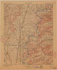
1901 Map of Pryor
USGS Topo · Published 1913About this map
The Neosho River carves a winding path through the heart of the Cherokee Nation territory in this early twentieth-century survey. Before the construction of modern bridges and dams, the river's transit was managed by numerous family-named crossings, including Markham Ferry, Sixkiller Ferry, Adair Ferry, and Earbob Ferry. These points of passage, alongside river fords like Island Ford and Adams Ford, underscore the essential water-based economy and transportation network of the era.
Find a feature on this map
47 named features on this map. Tap any name to fly to it.
Don’t see what you’re looking for? This feature index may not catch every label — zoom into the map to look around manually.
Map Details
Editions of this 1901 Pryor Map
5 editions found
Other maps of this area

1896 · Okmulgee
USGS Topo · 1:125,000

1896 · Pryor
USGS Topo · 1:125,000

1898 · Tahlequah
USGS Topo · 1:125,000

1899 · Siloam Springs
USGS Topo · 1:125,000

1900 · Okmulgee
USGS Topo · 1:125,000

1901 · Muscogee
USGS Topo · 1:125,000

1901 · Claremore
USGS Topo · 1:125,000

1901 · Nowata
USGS Topo · 1:125,000

1901 · Vinita
USGS Topo · 1:125,000

1901 · Pryor
USGS Topo · 1:125,000