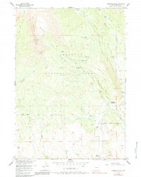
1956 Map of Ramshorn Peak
USGS Topo · Published 1984About this map
Shoshone National Forest defines this high-elevation landscape, where the dramatic ridge of The Ramshorn and Ramshorn Peak loom over a network of glacial lakes and mountain drainages. The mid-century topography reveals a working wilderness, where isolated outposts like the Horse Creek Ranger Station and Fisher Tie Camp supported land management and local industry. A system of horse trails and rugged tracks, including the Parque Trail and Firemile Jeep Trail, provided the primary means of traversal through the dense terrain.
Find a feature on this map
31 named features on this map. Tap any name to fly to it.
Don’t see what you’re looking for? This feature index may not catch every label — zoom into the map to look around manually.
Map Details
Editions of this 1956 Ramshorn Peak Map
4 editions found
Other maps of this area

1905 · Younts Peak
USGS Topo · 1:125,000

1907 · Younts Peak
USGS Topo · 1:125,000

1955 · Thermopolis
USGS Topo · 1:250,000

1956 · Indian Point
USGS Topo · 1:24,000

1956 · Dubois
USGS Topo · 1:24,000

1956 · Esmond Park
USGS Topo · 1:24,000

1956 · Shoshone Pass
USGS Topo · 1:24,000

1956 · Ramshorn Peak
USGS Topo · 1:24,000

1956 · Snow Lake
USGS Topo · 1:24,000

1956 · Warm Spring Mountain
USGS Topo · 1:24,000