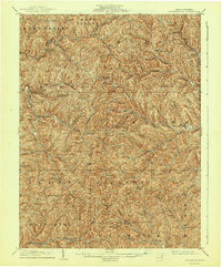
1905 Map of Rogersville
USGS Topo · Published 1944About this map
South Fork Tenmile Creek and its numerous branching runs carve a dense, dendritic landscape across Greene County in this 1903 survey. The terrain is defined by steep ridges and narrow valleys, where small post offices and crossroads settlements like Wind Ridge P.O. Jacktown, Graysville, and Bristoria serve as the primary social hubs for a dispersed rural population. The drainage patterns of Robinson Fork and Enlow Fork in the northwest give way to the complex network of Hoge Run, House Run, and Lick Run in the central townships, illustrating how topography dictated the placement of early roads and homesteads.
Find a feature on this map
67 named features on this map. Tap any name to fly to it.
Don’t see what you’re looking for? This feature index may not catch every label — zoom into the map to look around manually.
Map Details
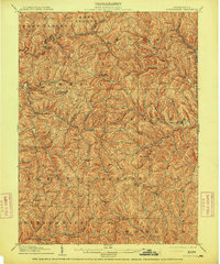
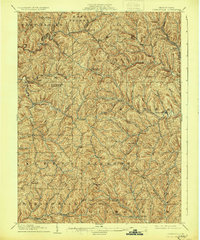
Editions of this 1905 Rogersville Map
4 editions found

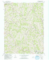
Historical Maps of East Finley Township Through Time
3 maps found
Featured Locations
- Aleppo Township, PA
- East Finley Township, PA
- West Finley Township, PA
- New Freeport, Freeport Township
- Deer Lick, Morris Township