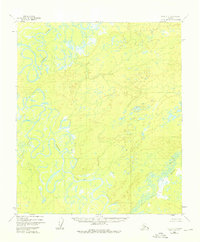
1952 Map of Ruby C-3
USGS Topo · Published 1976About this map
Nowitna River meanders through this portion of the Alaskan interior, defining a landscape dominated by complex fluvial systems and seasonal wetlands. Photogrammetric methods from 1952 reveal an intricate network of oxbow lakes, sloughs, and marshy basins that characterize this river valley. The confluence of the Sulatna River with the Nowitna highlights the hydraulic patterns of the region's lower elevations, while the Little Mud River winds through the southeastern portion of the quadrangle.
Find a feature on this map
4 named features on this map. Tap any name to fly to it.
Don’t see what you’re looking for? This feature index may not catch every label — zoom into the map to look around manually.
Map Details
Editions of this 1952 Ruby C-3 Map
4 editions found
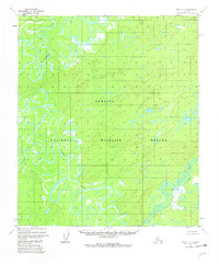

Other maps of this area

1951 · Ruby
USGS Topo · 1:250,000

1952 · Ruby B-2
USGS Topo · 1:63,360

1952 · Ruby D-4
USGS Topo · 1:63,360

1952 · Ruby C-3
USGS Topo · 1:63,360

1952 · Ruby B-4
USGS Topo · 1:63,360

1952 · Ruby C-2
USGS Topo · 1:63,360

1952 · Ruby B-3
USGS Topo · 1:63,360

1952 · Ruby D-3
USGS Topo · 1:63,360

1952 · Ruby D-2
USGS Topo · 1:63,360

1952 · Ruby C-4
USGS Topo · 1:63,360