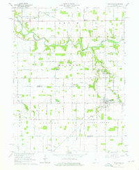
1961 Map of Russiaville
USGS Topo · Published 1976About this map
Russiaville anchors the southeastern corner of this central Indiana landscape, where the grid of rural roads meets the diagonal path of the Chicago and St Louis railroad. The terrain is defined by the winding course of Wildcat Creek and its tributaries, including Honey Creek and Petes Run. This 1961 survey captures a series of small agricultural settlements and rural social hubs, from the crossroads at Shanghai to the historic cluster at New London.
Find a feature on this map
34 named features on this map. Tap any name to fly to it.
Don’t see what you’re looking for? This feature index may not catch every label — zoom into the map to look around manually.
Map Details
Editions of this 1961 Russiaville Map
Other maps of this area

1953 · Danville
USGS Topo · 1:250,000

1955 · Danville
USGS Topo · 1:250,000

1956 · Danville
USGS Topo · 1:250,000

1959 · Galveston
USGS Topo · 1:24,000

1959 · Young America
USGS Topo · 1:24,000

1960 · Kokomo West
USGS Topo · 1:24,000

1960 · Kempton
USGS Topo · 1:24,000

1961 · Michigantown
USGS Topo · 1:24,000

1961 · Russiaville
USGS Topo · 1:24,000

1961 · Hillisburg
USGS Topo · 1:24,000