
1960 Map of Rutland
USGS Topo · Published 1961About this map
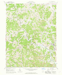
Leading Creek and its many winding tributaries define the rural landscape of Meigs County in 1960. The industrial footprint of the era is clearly visible through numerous Strip Mines scattered across the township boundaries of Rutland, Salem, and Sciplo. These operations appear alongside traditional agricultural patterns, noted by the intricate network of fence and field lines recorded during the survey. The New York Central railroad corridor tracks alongside the water, serving the small hilltop and valley settlements that anchored local life.
Find a feature on this map
62 named features on this map. Tap any name to fly to it.
Don’t see what you’re looking for? This feature index may not catch every label — zoom into the map to look around manually.
Map Details
Editions of this 1960 Rutland Map
4 editions found
Other maps of this area

1905 · Wilkesville
USGS Topo · 1:62,500

1906 · Bidwell
USGS Topo · 1:62,500

1907 · Pomeroy
USGS Topo · 1:62,500

1908 · Bidwell
USGS Topo · 1:62,500

1908 · Point Pleasant
USGS Topo · 1:62,500

1908 · Wilkesville
USGS Topo · 1:62,500

1926 · Point Pleasant
USGS Topo · 1:62,500

1929 · Point Pleasant
USGS Topo · 1:62,500

1947 · Columbus
USGS Topo · 1:250,000

1957 · Huntington
USGS Topo · 1:250,000