
1953 Map of Saint Cloud
USGS Topo · Published 1968About this map
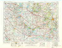
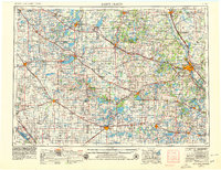
Saint Cloud and the surrounding central Minnesota landscape are defined by a complex network of glacial lakes and an established mid-century transportation corridor. As seen in this mid-1950s data, revised in the late 1960s, the region is anchored by the Great Northern Railway and U.S. Highway 52, connecting major trade centers like Alexandria, Willmar, and Little Falls. The map reveals the critical importance of institutional and military footprints, notably the expansive Camp Ripley to the north and the campus of St. Johns University near Collegeville.
Find a feature on this map
319 named features on this map. Tap any name to fly to it.
Don’t see what you’re looking for? This feature index may not catch every label — zoom into the map to look around manually.
Map Details
Editions of this 1953 Saint Cloud Map
3 editions found
Other maps of this area

1910 · Wendell
USGS Topo · 1:62,500

1910 · Chokio
USGS Topo · 1:62,500

1911 · Barrett
USGS Topo · 1:62,500

1911 · Herman
USGS Topo · 1:62,500

1912 · Chokio
USGS Topo · 1:62,500

1912 · Morris
USGS Topo · 1:62,500

1913 · Ashby
USGS Topo · 1:62,500

1913 · Wendell
USGS Topo · 1:62,500

1947 · Flensburg
USGS Topo · 1:25,000

1948 · Belle Prairie
USGS Topo · 1:62,500