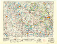
1953 Map of Saint Cloud
USGS Topo · Published 1979About this map
The Mississippi River defines the eastern corridor of this central Minnesota landscape, where the growing city of Saint Cloud sits at a major transit nexus. As of this mid-century record, the region is characterized by a dense network of glacial lakes and an established agricultural economy connected by the G. N. Ry. and N. P. Ry. rail lines. To the north, Little Falls marks a significant river crossing near the Charles A. Lindbergh State Park. The map reveals a distinct cultural geography through its numerous rural parishes, including St. Stephen Ch, St. Wendel Ch, and St. Joseph Ch, which anchor small farming communities across Stearns County. Vast water bodies like Lake Minnewaska, Lake Miltona, and Lake Carlos dominate the western portion of the sheet near Alexandria, highlighting the area's transition into the lake-rich heart of the state. Industrial activity is noted through scattered Gravel Pits and a Quarry, while the Chippewa River meanders toward the Big Bend in the southwest.
Find a feature on this map
247 named features on this map. Tap any name to fly to it.
Don’t see what you’re looking for? This feature index may not catch every label — zoom into the map to look around manually.
Map Details
Editions of this 1953 Saint Cloud Map
3 editions found

Other maps of this area

1910 · Wendell
USGS Topo · 1:62,500

1910 · Chokio
USGS Topo · 1:62,500

1911 · Barrett
USGS Topo · 1:62,500

1911 · Herman
USGS Topo · 1:62,500

1912 · Chokio
USGS Topo · 1:62,500

1912 · Morris
USGS Topo · 1:62,500

1913 · Ashby
USGS Topo · 1:62,500

1913 · Wendell
USGS Topo · 1:62,500

1947 · Flensburg
USGS Topo · 1:25,000

1948 · Belle Prairie
USGS Topo · 1:62,500