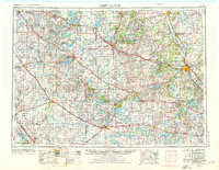
1953 Map of Saint Cloud
USGS Topo · Published 1976About this map
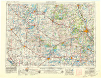
The Great Northern, Northern Pacific, and Soo Line railroads form a dense lattice across the Central Minnesota landscape, connecting dozens of agricultural hubs and lake settlements. This mid-century survey illustrates the region's reliance on these rail corridors for the transport of goods from centers like Willmar and Litchfield toward the growing regional hub of Saint Cloud. The terrain is defined by its glacial heritage, featuring the prominent Leaf Hills in the northwest and an extensive network of water bodies, including the massive Lake Minnewaska and the Green Lake resort area. Beyond the major rail junctions, smaller towns such as Kandiyohi, Atwater, and Starbuck sit along the primary arteries of U.S. 12 and U.S. 52. The survey also tracks the critical drainage basins of the Chippewa River and the Pomme de Terre River as they wind toward the Minnesota River and Mississippi River respectively.
Find a feature on this map
173 named features on this map. Tap any name to fly to it.
Don’t see what you’re looking for? This feature index may not catch every label — zoom into the map to look around manually.
Map Details
Editions of this 1953 Saint Cloud Map
3 editions found

Other maps of this area

1910 · Wendell
USGS Topo · 1:62,500

1910 · Chokio
USGS Topo · 1:62,500

1911 · Barrett
USGS Topo · 1:62,500

1911 · Herman
USGS Topo · 1:62,500

1912 · Chokio
USGS Topo · 1:62,500

1912 · Morris
USGS Topo · 1:62,500

1913 · Ashby
USGS Topo · 1:62,500

1913 · Wendell
USGS Topo · 1:62,500

1947 · Flensburg
USGS Topo · 1:25,000

1948 · Belle Prairie
USGS Topo · 1:62,500