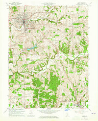
1963 Map of Salem
USGS Topo · Published 1965About this map
The county seat of Salem is the focal point of this mid-century survey, surrounded by established neighborhoods like Martin Heights, McCoy Place, and Fair Acres. The local infrastructure of the era is clearly visible, from the Fairgrounds and High School to the Radio Towers (WSLM) and the Sewage Disposal plant. The rugged topography of southern Indiana is defined by the three forks of the Blue River, which weave through the townships of Washington, Pierce, and Polk.
Find a feature on this map
37 named features on this map. Tap any name to fly to it.
Don’t see what you’re looking for? This feature index may not catch every label — zoom into the map to look around manually.
Map Details
Editions of this 1963 Salem Map
4 editions found
Other maps of this area

1941 · Borden
USGS Topo · 1:24,000

1950 · Salem
USGS Topo · 1:24,000

1950 · Becks Mill
USGS Topo · 1:24,000

1950 · Palmyra
USGS Topo · 1:24,000

1951 · Smedley
USGS Topo · 1:24,000

1953 · Fredericksburg
USGS Topo · 1:24,000

1953 · Kossuth
USGS Topo · 1:24,000

1955 · South Boston
USGS Topo · 1:24,000

1956 · Vincennes
USGS Topo · 1:250,000

1956 · Louisville
USGS Topo · 1:250,000