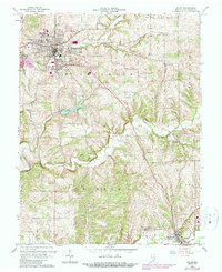
1963 Map of Salem
USGS Topo · Published 1989About this map
Salem serves as the regional hub for this Washington County landscape, where the confluence of the West Fork Blue River and several smaller branches shaped the early settlement pattern. The industrial and transit character of the mid-20th century is clearly visible through the path of the Monon RR and the concentration of local infrastructure like the sewage disposal and filtration plant near Lake Salinda. Residential growth is evident in outskirts such as Martin Heights, McCol Place, and Fair Acres. For those researching local lineages, the map identifies numerous rural burial grounds including Old Blue River Cem, Wright Cem, and Paynter Cem, alongside country congregations like Blue River Ch and College Hill Ch. To the southeast, the secondary center of New Pekin anchors the South Fork Blue River valley.
Find a feature on this map
37 named features on this map. Tap any name to fly to it.
Don’t see what you’re looking for? This feature index may not catch every label — zoom into the map to look around manually.
Map Details
Editions of this 1963 Salem Map
4 editions found
Other maps of this area

1941 · Borden
USGS Topo · 1:24,000

1950 · Salem
USGS Topo · 1:24,000

1950 · Becks Mill
USGS Topo · 1:24,000

1950 · Palmyra
USGS Topo · 1:24,000

1951 · Smedley
USGS Topo · 1:24,000

1953 · Fredericksburg
USGS Topo · 1:24,000

1953 · Kossuth
USGS Topo · 1:24,000

1955 · South Boston
USGS Topo · 1:24,000

1956 · Vincennes
USGS Topo · 1:250,000

1956 · Louisville
USGS Topo · 1:250,000