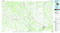
1985 Map of San Saba
USGS Topo · Published 1985About this map
The Colorado River and San Saba River converge in this Central Texas landscape, defining a region of limestone uplands and river valleys. During the mid-1980s, the area remained a network of established ranching hubs and smaller crossroads such as Richland Springs, Goldthwaite, and Lometa. The transportation corridors are dominated by the Atchison Topeka and Santa Fe railroad, which cuts across the terrain alongside major arteries like US Highway 183 and US Highway 190.
Find a feature on this map
78 named features on this map. Tap any name to fly to it.
Don’t see what you’re looking for? This feature index may not catch every label — zoom into the map to look around manually.
Map Details
Editions of this 1985 San Saba Map
2 editions found
Other maps of this area

1885 · San Saba
USGS Topo · 1:125,000

1887 · Llano
USGS Topo · 1:125,000

1887 · Lampasas
USGS Topo · 1:125,000

1887 · Mason
USGS Topo · 1:125,000

1887 · Burnet
USGS Topo · 1:125,000

1887 · Coleman
USGS Topo · 1:125,000

1888 · Hamilton
USGS Topo · 1:125,000

1888 · Meridian
USGS Topo · 1:125,000

1889 · Brownwood
USGS Topo · 1:125,000

1889 · Coleman
USGS Topo · 1:125,000