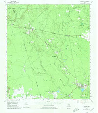
1955 Map of Saratoga
USGS Topo · Published 1980About this map
The industrial and natural landscape of Hardin County is defined here by the Saratoga Oil Field and Batson Oil Field, centers of the early 20th-century Texas oil boom. The map reveals a dense network of petroleum infrastructure, including numerous oil wells and tanks, alongside established settlements like Saratoga and Batson. The local economy of the mid-1950s is further illustrated by the Gulf Colorado and Santa Fe railroad line, which connected the timber and oil regions via stops at Votaw and Bragg.
Find a feature on this map
56 named features on this map. Tap any name to fly to it.
Don’t see what you’re looking for? This feature index may not catch every label — zoom into the map to look around manually.
Map Details
Editions of this 1955 Saratoga Map
4 editions found
Other maps of this area

1943 · Liberty
USGS Topo · 1:125,000

1954 · Beaumont
USGS Topo · 1:250,000

1955 · Daisetta
USGS Topo · 1:62,500

1955 · Saratoga
USGS Topo · 1:62,500

1955 · Kountze
USGS Topo · 1:62,500

1955 · Sour Lake
USGS Topo · 1:62,500

1955 · Rayburn
USGS Topo · 1:62,500

1955 · Liberty
USGS Topo · 1:62,500

1957 · Beaumont
USGS Topo · 1:250,000

1958 · Livingston
USGS Topo · 1:62,500