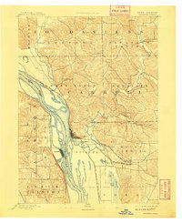
1892 Map of Savanna
USGS Topo · Published 1908About this map
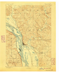
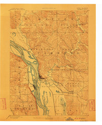
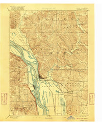
The Mississippi River creates a complex landscape of braided channels and backwater sloughs in this 1890s reconnaissance of the Illinois and Iowa borderlands. Savanna, Illinois, sits at a critical junction where the riverbank meets the rising bluffs of Carroll County, serving as a hub for both the Chicago Milwaukee and St. Paul Railroad and the Chicago Burlington and Northern Railroad. Across the water, the settlement of Sabula occupies a narrow peninsula on the Iowa side, surrounded by the shifting currents of the main channel and tributary waters. Inland, the topography transitions from the low floodplains of Idens Lake and Dyson Lake to the dissected hills of Jo Daviess County. The drainage patterns of the Plum River and Straddle Creek illustrate the rugged river-bluff environment before modern flood control and bridge systems transformed these crossings.
Find a feature on this map
29 named features on this map. Tap any name to fly to it.
Don’t see what you’re looking for? This feature index may not catch every label — zoom into the map to look around manually.
Map Details
Editions of this 1892 Savanna Map
8 editions found
Other maps of this area

1891 · Clinton
USGS Topo · 1:62,500

1892 · Goose Lake
USGS Topo · 1:62,500

1892 · Savanna
USGS Topo · 1:62,500

1894 · Goose Lake
USGS Topo · 1:62,500

1894 · Clinton
USGS Topo · 1:62,500

1899 · Clinton
USGS Topo · 1:125,000

1911 · Elizabeth
USGS Topo · 1:62,500

1911 · Galena
USGS Topo · 1:62,500

1913 · Galena
USGS Topo · 1:62,500

1934 · Morrison
USGS Topo · 1:48,000