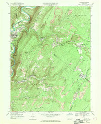
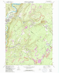
1968 Map of Saxton
USGS Topo · Published 1970About this map
The Raystown Branch Juniata River carves a sharp, winding course through the northwestern corner of this quadrangle, defining the terrain near Saxton and East Saxton. This 1968 study reveals a landscape heavily shaped by industrial activity, with dozens of Strip Mine operations scattered across the ridges of Carbon and Broad Top townships. The map is a vital record for genealogists, detailing small mining settlements like Coalmont, Barnettstown, and Dudley that once supported the local coal economy. In the valleys, numerous family-named and community landmarks appear, including Grandview Cem and St Michaels Cem. Higher elevations are dominated by State Game Lands No 67 and the rugged profile of Terrace Mountain, while an Abandoned railroad grade near Wood signals the shifting transportation and industrial patterns of the late 1960s.
Find a feature on this map
65 named features on this map. Tap any name to fly to it.
Don’t see what you’re looking for? This feature index may not catch every label — zoom into the map to look around manually.
Map Details
Editions of this 1968 Saxton Map
5 editions found
Other maps of this area

1900 · Everett
USGS Topo · 1:62,500

1901 · Huntingdon
USGS Topo · 1:62,500

1902 · Everett
USGS Topo · 1:62,500

1902 · Hollidaysburg
USGS Topo · 1:62,500

1903 · Hollidaysburg
USGS Topo · 1:62,500

1904 · Huntingdon
USGS Topo · 1:62,500

1930 · Broad Top
USGS Topo · 1:62,500

1933 · Broad Top
USGS Topo · 1:62,500

1953 · Pittsburgh
USGS Topo · 1:250,000

1954 · Pittsburgh
USGS Topo · 1:250,000