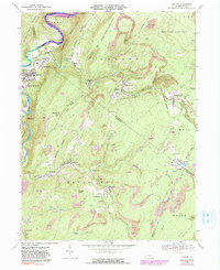
1968 Map of Saxton
USGS Topo · Published 1991About this map
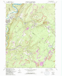
Saxton serves as a primary hub in this coal-rich region of Pennsylvania, positioned along the Raystown Branch Juniata River where the valley floor meets the base of Saxton Mountain. The landscape is heavily defined by the extraction economy, with numerous Strip Mines and industrial workings dotting the ridges between settlements like Coalmont, Dudley, and Broad Top City. The proximity of State Game Lands No 67 and Warriors Path State Park contrasts the industrial scars of mining with conserved timberlands.
Find a feature on this map
57 named features on this map. Tap any name to fly to it.
Don’t see what you’re looking for? This feature index may not catch every label — zoom into the map to look around manually.
Map Details
Editions of this 1968 Saxton Map
5 editions found
Other maps of this area

1900 · Everett
USGS Topo · 1:62,500

1901 · Huntingdon
USGS Topo · 1:62,500

1902 · Everett
USGS Topo · 1:62,500

1902 · Hollidaysburg
USGS Topo · 1:62,500

1903 · Hollidaysburg
USGS Topo · 1:62,500

1904 · Huntingdon
USGS Topo · 1:62,500

1930 · Broad Top
USGS Topo · 1:62,500

1933 · Broad Top
USGS Topo · 1:62,500

1953 · Pittsburgh
USGS Topo · 1:250,000

1954 · Pittsburgh
USGS Topo · 1:250,000