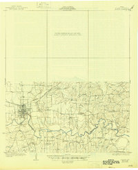
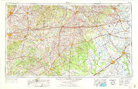
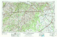
1953 Map of Seguin
USGS Topo · Published 1965This historical map portrays the area of Seguin in 1953, primarily covering Guadalupe County as well as portions of Wilson County, Caldwell County, Fort Bend County, Jackson County, Karnes County, Wharton County, Matagorda County, Hays County, Austin County, Comal County, Fayette County, Bastrop County, Victoria County, Colorado County, Lavaca County, DeWitt County, Gonzales County, and Waller County. Featuring a scale of 1:250000, this map provides a highly detailed snapshot of the terrain, roads, buildings, counties, and historical landmarks in the Seguin region at the time. Published in 1965, it is one of 4 known editions of this map due to revisions or reprints.
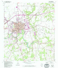
Find a feature on this map
83 named features on this map. Tap any name to fly to it.
Don’t see what you’re looking for? This feature index may not catch every label — zoom into the map to look around manually.
Map Details
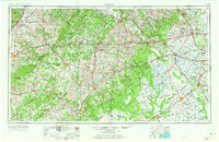
Editions of this 1953 Seguin Map
4 editions found
Historical Maps of Staples Through Time
5 maps found