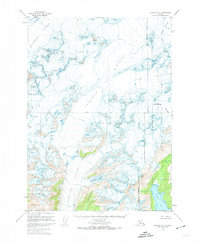
1951 Map of Seward A-5
USGS Topo · Published 1974About this map
Sargent Ice Field dominates the high-elevation landscape of the Kenai Peninsula Borough in this mid-century survey. The terrain is defined by the massive radial outflow of ice, with the Ellsworth Glacier carving north and the Excelsior Glacier pushing toward Excelsior Lake in the south. The mapping reflects the era's photogrammetric efforts, showing intricate contour work across the Chenega Glacier and Tiger Glacier systems before modern climate shifts. In the southeast, the land meets the sea at Puget Bay, overlooked by the prominent Puget Peak. This map preserves the 1950s extent of these frozen giants within the Chugach National Forest, including the surveyed Seward Base Line that bisects the glacial interior.
Find a feature on this map
13 named features on this map. Tap any name to fly to it.
Don’t see what you’re looking for? This feature index may not catch every label — zoom into the map to look around manually.
Map Details
Editions of this 1951 Seward A-5 Map
4 editions found
Other maps of this area

1946 · Blying Sound
USGS Topo · 1:250,000

1950 · Seward A-6
USGS Topo · 1:63,360

1950 · Blying Sound D-6
USGS Topo · 1:63,360

1950 · Blying Sound D-4
USGS Topo · 1:63,360

1950 · Blying Sound D-5
USGS Topo · 1:63,360

1951 · Blying Sound
USGS Topo · 1:250,000

1951 · Seward
USGS Topo · 1:250,000

1951 · Seward A-6
USGS Topo · 1:63,360

1951 · Seward B-4
USGS Topo · 1:63,360

1951 · Seward A-5
USGS Topo · 1:63,360