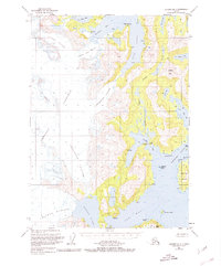
1951 Map of Seward B-4
USGS Topo · Published 1980About this map
Sargent Icefield dominates the western interior of this coastal Alaskan landscape, where massive ice flows like Princeton Glacier and Ultramarine Glacier descend toward the sea. The 1951 field data shows the dramatic intersection of glacial geography and the deep waters of Prince William Sound, particularly where Chenega Glacier meets the head of Nassau Fiord. Along the eastern shoreline, the intricate coastline is defined by Dangerous Passage and the sheltered waters of Jackpot Bay, which serves as the outlet for the Jackpot Lakes system. This survey preserves the topographical relationship between high summits like Saddle Peak and the maritime environment of Chenega Island, providing a detailed look at the region's hydrography and ice coverage before late-twentieth-century glacial shifts.
Find a feature on this map
24 named features on this map. Tap any name to fly to it.
Don’t see what you’re looking for? This feature index may not catch every label — zoom into the map to look around manually.
Map Details
Editions of this 1951 Seward B-4 Map
3 editions found
Other maps of this area

1950 · Seward B-3
USGS Topo · 1:63,360

1951 · Seward
USGS Topo · 1:250,000

1951 · Seward B-4
USGS Topo · 1:63,360

1951 · Seward C-5
USGS Topo · 1:63,360

1951 · Seward A-5
USGS Topo · 1:63,360

1951 · Seward A-3
USGS Topo · 1:63,360

1951 · Seward B-5
USGS Topo · 1:63,360

1951 · Seward A-4
USGS Topo · 1:63,360

1951 · Seward C-4
USGS Topo · 1:63,360

1951 · Seward C-3
USGS Topo · 1:63,360