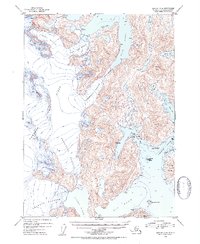
1952 Map of Seward B-4
USGS Topo · Published 1954About this map
Sargent Ice Field dominates the western interior of this coastal Alaskan landscape, feeding a massive system of tidewater and hanging glaciers including the Princeton Glacier and the Chenega Glacier. This mid-century survey captures the glaciated coastline of the Chugach National Forest before significant modern changes, documenting a complex network of deep-water inlets such as Blue Fiord and Nassau Fiord. To the east, the map details the intricate shoreline of Chenega Island and the neighboring Jackpot Island within the waters of Dangerous Passage. Landforms like Saddle Peak and significant inland bodies of water such as Ewan Lake and Eshamy Lake provide critical reference points for understanding the hydrologic and topographic character of the Prince William Sound region during this era.
Find a feature on this map
23 named features on this map. Tap any name to fly to it.
Don’t see what you’re looking for? This feature index may not catch every label — zoom into the map to look around manually.
Map Details
Editions of this 1952 Seward B-4 Map
2 editions found

Other maps of this area

1950 · Seward B-3
USGS Topo · 1:63,360

1951 · Seward
USGS Topo · 1:250,000

1951 · Seward B-4
USGS Topo · 1:63,360

1951 · Seward C-5
USGS Topo · 1:63,360

1951 · Seward A-5
USGS Topo · 1:63,360

1951 · Seward A-3
USGS Topo · 1:63,360

1951 · Seward B-5
USGS Topo · 1:63,360

1951 · Seward A-4
USGS Topo · 1:63,360

1951 · Seward C-4
USGS Topo · 1:63,360

1951 · Seward C-3
USGS Topo · 1:63,360