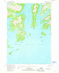
1951 Map of Seward D-2
USGS Topo · Published 1968About this map
Kiniklik stands on the northern shores of Prince William Sound, marking a point of former settlement within the Chugach National Forest. This 1951 survey, annotated with data from earlier aerial photography, details the complex fjord system of Unakwik Inlet and Wells Bay. The landscape is defined by its deep coastal indentations and numerous islands, ranging from the large Fairmount Island to the smaller Jenny Islands and Outpost Island.
Find a feature on this map
29 named features on this map. Tap any name to fly to it.
Don’t see what you’re looking for? This feature index may not catch every label — zoom into the map to look around manually.
Map Details
Editions of this 1951 Seward D-2 Map
4 editions found
Other maps of this area

1951 · Seward
USGS Topo · 1:250,000

1951 · Anchorage
USGS Topo · 1:250,000

1951 · Seward D-2
USGS Topo · 1:63,360

1951 · Seward D-1
USGS Topo · 1:63,360

1951 · Seward D-3
USGS Topo · 1:63,360

1951 · Seward C-1
USGS Topo · 1:63,360

1951 · Seward C-3
USGS Topo · 1:63,360

1951 · Seward C-2
USGS Topo · 1:63,360

1952 · Seward C-1
USGS Topo · 1:63,360

1952 · Seward D-1
USGS Topo · 1:63,360