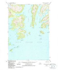
1951 Map of Seward D-2
USGS Topo · Published 1988About this map
Prince William Sound defines the lower reaches of this coastal landscape, where the tides of the Gulf of Alaska meet a complex network of deep-water fjords and islands. The interior waterways, including Unakwik Inlet and Wells Bay, provide protected passage through a region where maritime activity is central to survival. Near Fairmount Pt, a Seaplane Anchorage serves as a vital transportation link, reflecting the era's reliance on air and sea travel in the absence of roads.
Find a feature on this map
51 named features on this map. Tap any name to fly to it.
Don’t see what you’re looking for? This feature index may not catch every label — zoom into the map to look around manually.
Map Details
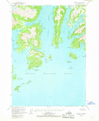
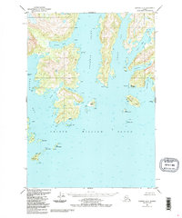
Editions of this 1951 Seward D-2 Map
4 editions found
Other maps of this area

1951 · Seward
USGS Topo · 1:250,000

1951 · Anchorage
USGS Topo · 1:250,000

1951 · Seward D-2
USGS Topo · 1:63,360

1951 · Seward D-1
USGS Topo · 1:63,360

1951 · Seward D-3
USGS Topo · 1:63,360

1951 · Seward C-1
USGS Topo · 1:63,360

1951 · Seward C-3
USGS Topo · 1:63,360

1951 · Seward C-2
USGS Topo · 1:63,360

1952 · Seward C-1
USGS Topo · 1:63,360

1952 · Seward D-1
USGS Topo · 1:63,360