
1950 Map of Solomon
USGS Topo · Published 1956About this map
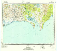
The Seward Peninsula coastline and its inland mining districts are meticulously detailed in this mid-century survey. The southern shore along Norton Sound and Norton Bay reveals a network of coastal settlements and landing areas, including Solomon, Golovin, and Elim. Inland, the importance of the regional mining economy is evident through the presence of the Big Hurrah Mine and remote outposts like Quigley's Camp and Lee's Camp.
Find a feature on this map
88 named features on this map. Tap any name to fly to it.
Don’t see what you’re looking for? This feature index may not catch every label — zoom into the map to look around manually.
Map Details
Editions of this 1950 Solomon Map
5 editions found
Other maps of this area

1907 · Casadepaga
USGS Topo · 1:62,500

1907 · Solomon
USGS Topo · 1:62,500

1948 · Norton Bay
USGS Topo · 1:250,000

1950 · Bendeleben A-6
USGS Topo · 1:63,360

1950 · Bendeleben A-4
USGS Topo · 1:63,360

1950 · Bendeleben A-5
USGS Topo · 1:63,360

1950 · Bendeleben A-3
USGS Topo · 1:63,360

1950 · Bendeleben A-2
USGS Topo · 1:63,360

1950 · Bendeleben A-1
USGS Topo · 1:63,360

1950 · Solomon B-3
USGS Topo · 1:63,360