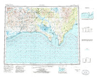
1950 Map of Solomon
USGS Topo · Published 1985About this map
Solomon and the neighboring coastal reaches of the Seward Peninsula are characterized here by a network of mining-era camps and roadhouses situated between the Kigluaik Mountains and the icy waters of Norton Sound. This survey captures the lingering geography of the gold rush, where the Solomon River and Casadepaga River served as vital corridors for early territorial development. Settlements like Council and White Mountain anchor the interior river systems, while remote stopovers such as Ruby Roadhouse and Portage Roadhouse illustrate the necessity of established shelters along the region's arduous overland routes. The presence of specialized sites like Quigleys Camp and Lee Camp underscores the localized industry that shaped the landscape, while the coastal Golovnin Lagoon and Safety Sound provided the essential maritime access that sustained these distant communities.
Find a feature on this map
67 named features on this map. Tap any name to fly to it.
Don’t see what you’re looking for? This feature index may not catch every label — zoom into the map to look around manually.
Map Details
Editions of this 1950 Solomon Map
5 editions found

Other maps of this area

1907 · Casadepaga
USGS Topo · 1:62,500

1907 · Solomon
USGS Topo · 1:62,500

1948 · Norton Bay
USGS Topo · 1:250,000

1950 · Bendeleben A-6
USGS Topo · 1:63,360

1950 · Bendeleben A-4
USGS Topo · 1:63,360

1950 · Bendeleben A-5
USGS Topo · 1:63,360

1950 · Bendeleben A-3
USGS Topo · 1:63,360

1950 · Bendeleben A-2
USGS Topo · 1:63,360

1950 · Bendeleben A-1
USGS Topo · 1:63,360

1950 · Solomon B-3
USGS Topo · 1:63,360