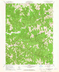
1961 Map of South Bloomingville
USGS Topo · Published 1967About this map
South Bloomingville sits at the confluence of Queer Creek and its southern tributaries, serving as a focal point for this Hocking County landscape in the early 1960s. The area is defined by a dense network of ridges and hollows, such as Barringer Ridge and Conkles Hollow, where small-scale agriculture and early industry left their mark. An intriguing label for a Gold Mine northwest of the village points to the region's diverse mineral history, while numerous gas wells scattered across the terrain indicate the mid-century energy economy.
Find a feature on this map
87 named features on this map. Tap any name to fly to it.
Don’t see what you’re looking for? This feature index may not catch every label — zoom into the map to look around manually.
Map Details
Editions of this 1961 South Bloomingville Map
4 editions found
Other maps of this area

1904 · Zaleski
USGS Topo · 1:62,500

1907 · Zaleski
USGS Topo · 1:62,500

1907 · Logan
USGS Topo · 1:62,500

1907 · Lancaster
USGS Topo · 1:62,500

1909 · Lancaster
USGS Topo · 1:62,500

1909 · Logan
USGS Topo · 1:62,500

1910 · Laurelville
USGS Topo · 1:62,500

1912 · Laurelville
USGS Topo · 1:62,500

1944 · Laurelville
USGS Topo · 1:62,500

1947 · Columbus
USGS Topo · 1:250,000