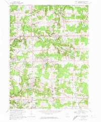
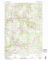
1963 Map of South Russell
USGS Topo · Published 1974About this map
The Chagrin River valley and its surrounding highlands define this portion of Geauga County in the early 1960s. The landscape is a mix of small settlements and emerging residential developments centered around water features like Lake Lucerne and Lake Louise. Distinctive rural crossroads such as McFarlands Corners and Yates Corners appear alongside established village centers in South Russell and Bainbridge. Local infrastructure is anchored by the Chagrin Falls Airport and the Novelty PO, reflecting the area's transition into a more populated suburban corridor.
Find a feature on this map
45 named features on this map. Tap any name to fly to it.
Don’t see what you’re looking for? This feature index may not catch every label — zoom into the map to look around manually.
Map Details
Editions of this 1963 South Russell Map
5 editions found
Other maps of this area

1904 · Chardon
USGS Topo · 1:62,500

1905 · Garrettsville
USGS Topo · 1:62,500

1905 · Mentor
USGS Topo · 1:62,500

1906 · Chardon
USGS Topo · 1:62,500

1906 · Chagrin Falls
USGS Topo · 1:62,500

1907 · Garrettsville
USGS Topo · 1:62,500

1907 · Mentor
USGS Topo · 1:62,500

1908 · Chagrin Falls
USGS Topo · 1:62,500

1950 · Cleveland
USGS Topo · 1:250,000

1953 · Chardon
USGS Topo · 1:24,000