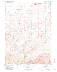
1951 Map of Split Rock NW
USGS Topo · Published 1978About this map
Sweetwater Rocks anchor the northern landscape of this Wyoming terrain, where the high desert floor meets granite outcrops. Surveyed in the early 1950s as part of the Department of the Interior's Missouri River Basin development program, the map illustrates an arid ranching environment reliant on sparse water sources. The Beaton Ditch represents the vital infrastructure of the era, diverting water from the Sweetwater R to sustain the local livestock economy. Multiple forks of Cottonwood Creek—the West Fork, Middle Fork, and East Fork—drain from the southern high ground of the Green Mountains and Owl Hills. This topography is shaped by the transition from the high peaks through Rocky Canyon into the open valley where Crooks Creek and scattered windmills mark the primary human presence on the land.
Find a feature on this map
16 named features on this map. Tap any name to fly to it.
Don’t see what you’re looking for? This feature index may not catch every label — zoom into the map to look around manually.
Map Details
Editions of this 1951 Split Rock NW Map
5 editions found
Other maps of this area

1951 · Crooks Creek NE
USGS Topo · 1:24,000

1951 · Stampede Meadow
USGS Topo · 1:24,000

1951 · Black Rock Gap
USGS Topo · 1:24,000

1951 · Split Rock
USGS Topo · 1:24,000

1951 · Split Rock NW
USGS Topo · 1:24,000

1951 · Lankin Dome
USGS Topo · 1:24,000

1955 · Casper
USGS Topo · 1:250,000

1957 · Jeffrey City
USGS Topo · 1:24,000

1958 · Casper
USGS Topo · 1:250,000

1961 · Crooks Peak
USGS Topo · 1:24,000