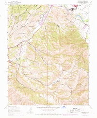
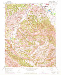
1947 Map of Spreckels
USGS Topo · Published 1969About this map
Fort Ord Military Reservation dominates the northern landscape of this region, where the rugged coastal ridges meet the fertile Salinas River valley. This 1947 survey, later updated with 1960s urban extensions, captures the transition from ranching life to mid-century development. In the southern foothills, traditional land grants like Corral De Tierra and Los Laurelles maintain their historical boundaries, while the education of rural children is marked by sites like Washington Union School and the already Lincoln School (Abandoned). The topography is defined by deep cuts such as San Benancio Gulch and Canyon Del Rey, while the industrial presence of Spreckels near the river signals the importance of the local sugar beet economy. Smaller family operations like Bingaman Ranch and Guidotti Ranch are connected by a network of winding mountain tracks including Skyline Road and Jacks Road.
Find a feature on this map
38 named features on this map. Tap any name to fly to it.
Don’t see what you’re looking for? This feature index may not catch every label — zoom into the map to look around manually.
Map Details
Editions of this 1947 Spreckels Map
8 editions found
Other maps of this area

1910 · Salinas
USGS Topo · 1:31,680

1912 · Salinas
USGS Topo · 1:62,500

1913 · Monterey
USGS Topo · 1:62,500

1918 · Point Sur
USGS Topo · 1:62,500

1920 · Jamesburg
USGS Topo · 1:48,000

1921 · Jamesburg
USGS Topo · 1:62,500

1925 · Point Sur
USGS Topo · 1:62,500

1939 · Jamesburg
USGS Topo · 1:62,500

1940 · Salinas
USGS Topo · 1:62,500

1940 · Jamesburg
USGS Topo · 1:62,500