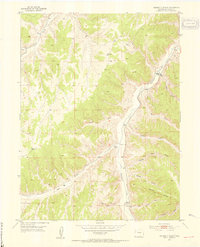
1952 Map of Square S Ranch
USGS Topo · Published 1954About this map
Square S Ranch serves as a primary reference point in this Rio Blanco County landscape, situated where Piceance Creek winds through the high plateaus of northwestern Colorado. The 1952 field check documents a region defined by extensive drainage systems and prominent relief, including Wolf Ridge and the steep Dudley Bluffs. Local history and genealogy interest is anchored by the Miller Hill Cem located near the southern reach of the creek.
Find a feature on this map
19 named features on this map. Tap any name to fly to it.
Don’t see what you’re looking for? This feature index may not catch every label — zoom into the map to look around manually.
Map Details
Editions of this 1952 Square S Ranch Map
5 editions found
Other maps of this area

1907 · White River
USGS Topo · 1:125,000

1910 · White River
USGS Topo · 1:125,000

1952 · Wolf Ridge
USGS Topo · 1:24,000

1952 · Yankee Gulch
USGS Topo · 1:24,000

1952 · Rock School
USGS Topo · 1:24,000

1952 · Jessup Gulch
USGS Topo · 1:24,000

1952 · Greasewood Gulch
USGS Topo · 1:24,000

1952 · Square S Ranch
USGS Topo · 1:24,000

1954 · Vernal
USGS Topo · 1:250,000

1956 · Grand Junction
USGS Topo · 1:250,000