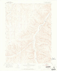
1952 Map of Square S Ranch
USGS Topo · Published 1965About this map
Square S Ranch serves as the namesake landmark for this 1952 field-checked quadrangle in Rio Blanco County, situated where Cole Gulch meets the winding Piceance Creek. The landscape is defined by a dense network of watercourses and draws, including Dudley Draw and Ryan Gulch, which carved deep incisions through the high plateau. The map captures a moment of established ranching life and early resource management, marked by the presence of a Windmill and the Miller Hill Cem overlooking the valley. Elevation is a dominant theme, reaching from the creek beds up to the Dudley Bluffs and the prominent VABM 6794 Tower. The transition between Townships 1 and 2 South is meticulously recorded, providing a clear view of the land divisions and remote drainage systems like Yellow Creek and Horse Draw before later modern developments in the Colorado oil shale region.
Find a feature on this map
20 named features on this map. Tap any name to fly to it.
Don’t see what you’re looking for? This feature index may not catch every label — zoom into the map to look around manually.
Map Details
Editions of this 1952 Square S Ranch Map
5 editions found
Other maps of this area

1907 · White River
USGS Topo · 1:125,000

1910 · White River
USGS Topo · 1:125,000

1952 · Wolf Ridge
USGS Topo · 1:24,000

1952 · Yankee Gulch
USGS Topo · 1:24,000

1952 · Rock School
USGS Topo · 1:24,000

1952 · Jessup Gulch
USGS Topo · 1:24,000

1952 · Greasewood Gulch
USGS Topo · 1:24,000

1952 · Square S Ranch
USGS Topo · 1:24,000

1954 · Vernal
USGS Topo · 1:250,000

1956 · Grand Junction
USGS Topo · 1:250,000