Loading...
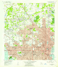
Loading map...1956 Map of St. Petersburg
USGS Topo · Published 1957About this map
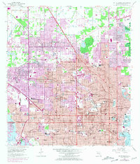
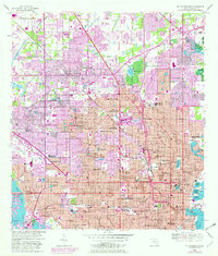
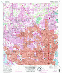
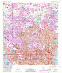
St Petersburg is captured during its mid-century expansion, a period of rapid development along the eastern shores of Boca Ciega Bay and the western edge of Tampa Bay. The map reveals a dense network of local institutions, from St Petersburg Jr College and Farragut Academy to numerous neighborhood schools like Rio Vista Sch and Gibbs High Sch. The urban fabric is structured by the Atlantic Coast Line and Seaboard Air Line railroads, which served the established communities of Pinellas Park and Lealman.
Find a feature on this map
88 named features on this map. Tap any name to fly to it.
Don’t see what you’re looking for? This feature index may not catch every label — zoom into the map to look around manually.
Map Details
Date Portrayed1956
Date Published1957
PublisherU.S. Geological Survey
Map TypeTopographic
Scale1:24,000
Physical Dimensions23.5 x 26.9 inches
Editions of this 1956 St. Petersburg Map
5 editions found
Historical Maps of Saint Petersburg Through Time
1 maps found
Featured Locations
Source Details
SourceU.S. Geological Survey
CopyrightPublic Domain