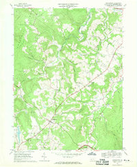
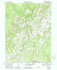
1967 Map of Stahlstown
USGS Topo · Published 1970About this map
Stahlstown and the surrounding rural townships of Cook, Donegal, Ligonier, and Unity are defined by the prominent ridge of Chestnut Ridge and a network of named runs. By the late 1960s, the landscape here remained largely agrarian, punctuated by family-named landmarks and local institutions like the Enoch Stahl Sch and Zion Ch. The transition from historic industry to mid-century recreation is visible in the presence of an old Quarry and Weaver Mill alongside the developing Ligonier Country Club.
Find a feature on this map
48 named features on this map. Tap any name to fly to it.
Don’t see what you’re looking for? This feature index may not catch every label — zoom into the map to look around manually.
Map Details
Editions of this 1967 Stahlstown Map
5 editions found
Other maps of this area

1900 · Latrobe
USGS Topo · 1:62,500

1902 · Latrobe
USGS Topo · 1:62,500

1903 · Latrobe
USGS Topo · 1:62,500

1913 · Somerset
USGS Topo · 1:62,500

1915 · Somerset
USGS Topo · 1:62,500

1920 · New Florence
USGS Topo · 1:62,500

1921 · New Florence
USGS Topo · 1:48,000

1922 · Donegal
USGS Topo · 1:62,500

1922 · New Florence
USGS Topo · 1:62,500

1935 · Donegal
USGS Topo · 1:62,500
Featured Places
- Ligonier Township, PA
- Unity Township, PA
- Pleasant Grove, Cook Township
- Cook Township, PA
- Stahlstown, Cook Township