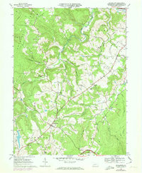
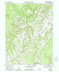
1967 Map of Stahlstown
USGS Topo · Published 1974About this map
Chestnut Ridge dominates the western skyline of this Westmoreland County landscape, where the rural character of Cook and Donegal townships is defined by a network of winding runs and family-named roads. The village of Stahlstown serves as a central hub, situated near the Enoch Stahl Sch and the waters of Keffer Run. To the east, the terrain transitions toward the high ground of the Forbes State Forest, while the northern reaches include the Ligonier Country Club and the banks of Loyalhanna Cr. Local industry and community life are reflected in features such as the Weaver Mill and several country churches like Zion Ch and Bethel Ch. Evidence of the region's extraction history is visible in a Quarry and Strip Mine located near Weaver Mill Creek, while the Pennsylvania Turnpike cuts across the southern edge of the quadrangle, signaling the modernization of this Appalachian corridor.
Find a feature on this map
55 named features on this map. Tap any name to fly to it.
Don’t see what you’re looking for? This feature index may not catch every label — zoom into the map to look around manually.
Map Details
Editions of this 1967 Stahlstown Map
5 editions found
Other maps of this area

1900 · Latrobe
USGS Topo · 1:62,500

1902 · Latrobe
USGS Topo · 1:62,500

1903 · Latrobe
USGS Topo · 1:62,500

1913 · Somerset
USGS Topo · 1:62,500

1915 · Somerset
USGS Topo · 1:62,500

1920 · New Florence
USGS Topo · 1:62,500

1921 · New Florence
USGS Topo · 1:48,000

1922 · Donegal
USGS Topo · 1:62,500

1922 · New Florence
USGS Topo · 1:62,500

1935 · Donegal
USGS Topo · 1:62,500
Featured Places
- Ligonier Township, PA
- Unity Township, PA
- Pleasant Grove, Cook Township
- Cook Township, PA
- Stahlstown, Cook Township